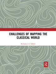
Challenges of Mapping the Classical World / by Richard J.A. Talbert.
Erişim Adresi
ISBN
9780429485688 (e-book : PDF)
Dil Kodu
İngilizce
İngilizce
İngilizce
Yazar
Basım Bildirimi
First edition.
Yayın Bilgisi
Boca Raton, FL : Routledge, [2018].
©2019.
©2019.
Fiziksel Niteleme
1 online resource (212 pages) : 89 illustrations, text file, PDF
Bibliyografi, vb. Notu
Includes bibliographical references and index.
İçindekiler Notu
Preface and Acknowledgments -- Introduction -- 1 Walter Goffarts Historical Atlases: The First Three Hundred Years, 1570-1870 (2003) Review in History Today December 2003, p. 58. -- 2 William Smith and George Grove (eds.), Atlas of Ancient Geography Biblical and Classical (1872-1874): Introduction to the 2013 Reissue (London: I. B. Tauris, 2013, pp. v-xii) -- 3 Carl Mller (1813-1894), S. Jacobs, and the Making of Classical Maps in Paris for John Murray (Imago Mundi 46: 1994. pp. 128-50) -- 4 A Forgotten Masterpiece of Cartography for Roman Historians: Pierre Lapies Orbis Romanus ad Illustranda Itineraria (1845) in H. M. Schellenberg, V. E. Hirschmann, Andreas Krieckhaus, eds., A Roman Miscellany: Essays in Honour of Anthony R. Birley on his Seventieth Birthday, Gdask: Gdask University, 2008, pp. 149-56 and maps. -- 5 Heinrich Kiepert, Formae Orbis Antiqui (1894-1914): Introduction to the 1996 Reissue (Rome: Edizioni Quasar, 1996, pp. V-VIII) -- 6 Sgolne Dbarres Cartographier lAsie Mineure: Lorientalisme allemand lpreuve du terrain (1835-1895) (2016) Review in Bryn Mawr Classical Review 2017.05.27. -- 7 The Primary Classical Atlases and Map Series between 1870 and 1990 (1992) -- 8 Classical Atlas Project: Narrative Description 1990 (unpublished) -- 9 Classical Atlas Project: Instructions for Compilers 1990 (unpublished) -- 10 Classical Atlas Project: Half-Yearly Reports to the U. S. National Endowment for the Humanities, August 1991 May 2000. Table: Giving and Commitments by Calendar Years (November 1995) (unpublished) -- 11 Barrington Atlas of the Greek and Roman World: The Cartographic Fundamentals in Retrospect (Cartographic Perspectives 46: 2003. pp. 4-27 and 72-76) -- 12 Maps of the Classical World: Where Do We Go from Here? (American Journal of Philology 118: 1997. pp. 323-27) -- 13 Mapping the Ancient World: GIS for History (co-authored with Tom Elliott) in A. K. Knowles, ed., Past Time, Past Place: GIS for History, Redlands, CA: ESRI Press, 2002, pp. 145-62. -- 14 Neue Paulys Historischer Atlas der antiken Welt (2007) Review of Anne-Maria Wittke, Eckart Olshausen, Richard Szydlak, Historischer Atlas der antiken Welt. Der Neue Pauly. Supplemente Band 3, Stuttgart/Weimar: Metzler, in Bryn Mawr Classical Review 2009.07.22) -- Index
Özet, vb.
Challenges of Mapping the Classical World collects together in one volume fourteen varied items written by Richard Talbert over the past thirty years. They cohere around the theme of mapping the classical world since the nineteenth century. All were originally prompted by Talbert’s commission in the late 1980s to produce a definitive classical atlas after more than a century of failed attempts by the Kieperts and others. These he evaluates, as well as probing the Smith/Grove atlas, a successful twenty-year initiative launched in the mid-1850s, with a cartographic approach that departs radically from established practice. Talbert’s initial vision for the international collaborative project that resulted in the Barrington Atlas of the Greek and Roman World (2000) is presented, and the successive twice-yearly reports on its progress from 1991 through to completion are published here for the first time. A further item reflects retrospectively on the project’s cartographic challenges and on how developments in digital map production were decisive in overcoming them. This volume will be invaluable to anyone with an interest in the development and growing impact of mapping the classical world.
Konu
Classical geography.
Cartography __ History __ To 1500.
Cartography.
Electronic books.
Cartography __ History __ To 1500.
Cartography.
Electronic books.
Kurum Adı
Veritabanı

Eseri Alıntıla
Referansları kullanmadan önce gözden geçirmeniz ve varsa gerekli düzeltmeleri yapmanız önerilir.
Dijital Kaynak
MARC Görünümü
LEADER 04882nam a2200433Ii 4500
001 802774
003 TR_AnAIT
005 20260123024456
006 m o d
007 cr
008 181112t20182019fluab ob 001 0 eng d
020 |a9780429485688|q(e-book : PDF)
035 |a(OCoLC)1043055071
040 |aFlBoTFG|cFlBoTFG|erda
041 1 |aeng
041 |aeng
049 |aTürk Tarih Kurumu Kütüphanesi
050 4|aDE29
072 7|aHIS|x000000 |2bisacsh
072 7|aHBLA1 |2bicscc
082 04|a912.38
100 1 |aTalbert, Richard J.A.,|eauthor.
245 10|aChallenges of Mapping the Classical World /|cby Richard J.A. Talbert.
250 |aFirst edition.
264 1|aBoca Raton, FL :|bRoutledge,|c[2018].
264 4|c©2019.
300 |a1 online resource (212 pages) :|b89 illustrations, text file, PDF
336 |atext|2rdacontent
337 |acomputer|2rdamedia
338 |aonline resource|2rdacarrier
504 |aIncludes bibliographical references and index.
505 00|tPreface and Acknowledgments -- |tIntroduction -- |t1 Walter Goffarts Historical Atlases: The First Three Hundred Years, 1570-1870 (2003) Review in History Today December 2003, p. 58. -- |t2 William Smith and George Grove (eds.), Atlas of Ancient Geography Biblical and Classical (1872-1874): Introduction to the 2013 Reissue (London: I. B. Tauris, 2013, pp. v-xii) -- |t3 Carl Mller (1813-1894), S. Jacobs, and the Making of Classical Maps in Paris for John Murray (Imago Mundi 46: 1994. pp. 128-50) -- |t4 A Forgotten Masterpiece of Cartography for Roman Historians: Pierre Lapies Orbis Romanus ad Illustranda Itineraria (1845) in H. M. Schellenberg, V. E. Hirschmann, Andreas Krieckhaus, eds., A Roman Miscellany: Essays in Honour of Anthony R. Birley on his Seventieth Birthday, Gdask: Gdask University, 2008, pp. 149-56 and maps. -- |t5 Heinrich Kiepert, Formae Orbis Antiqui (1894-1914): Introduction to the 1996 Reissue (Rome: Edizioni Quasar, 1996, pp. V-VIII) -- |t6 Sgolne Dbarres Cartographier lAsie Mineure: Lorientalisme allemand lpreuve du terrain (1835-1895) (2016) Review in Bryn Mawr Classical Review 2017.05.27. -- |t7 The Primary Classical Atlases and Map Series between 1870 and 1990 (1992) -- |t8 Classical Atlas Project: Narrative Description 1990 (unpublished) -- |t9 Classical Atlas Project: Instructions for Compilers 1990 (unpublished) -- |t10 Classical Atlas Project: Half-Yearly Reports to the U. S. National Endowment for the Humanities, August 1991 May 2000. Table: Giving and Commitments by Calendar Years (November 1995) (unpublished) -- |t11 Barrington Atlas of the Greek and Roman World: The Cartographic Fundamentals in Retrospect (Cartographic Perspectives 46: 2003. pp. 4-27 and 72-76) -- |t12 Maps of the Classical World: Where Do We Go from Here? (American Journal of Philology 118: 1997. pp. 323-27) -- |t13 Mapping the Ancient World: GIS for History (co-authored with Tom Elliott) in A. K. Knowles, ed., Past Time, Past Place: GIS for History, Redlands, CA: ESRI Press, 2002, pp. 145-62. -- |t14 Neue Paulys Historischer Atlas der antiken Welt (2007) Review of Anne-Maria Wittke, Eckart Olshausen, Richard Szydlak, Historischer Atlas der antiken Welt. Der Neue Pauly. Supplemente Band 3, Stuttgart/Weimar: Metzler, in Bryn Mawr Classical Review 2009.07.22) -- |tIndex
520 3 |aChallenges of Mapping the Classical World collects together in one volume fourteen varied items written by Richard Talbert over the past thirty years. They cohere around the theme of mapping the classical world since the nineteenth century. All were originally prompted by Talbert’s commission in the late 1980s to produce a definitive classical atlas after more than a century of failed attempts by the Kieperts and others. These he evaluates, as well as probing the Smith/Grove atlas, a successful twenty-year initiative launched in the mid-1850s, with a cartographic approach that departs radically from established practice. Talbert’s initial vision for the international collaborative project that resulted in the Barrington Atlas of the Greek and Roman World (2000) is presented, and the successive twice-yearly reports on its progress from 1991 through to completion are published here for the first time. A further item reflects retrospectively on the project’s cartographic challenges and on how developments in digital map production were decisive in overcoming them. This volume will be invaluable to anyone with an interest in the development and growing impact of mapping the classical world.
530 |aAlso available in print format.
650 0|aClassical geography.
650 0|aCartography|yHistory|xTo 1500.
650 0|aCartography.
655 0|aElectronic books.
710 2 |aTaylor and Francis.
776 08|iPrint version: |z9781472457820
856 40|uhttps://www.taylorfrancis.com/books/9780429485688|zClick here to view.
901 |aTaylor & Francis
001 802774
003 TR_AnAIT
005 20260123024456
006 m o d
007 cr
008 181112t20182019fluab ob 001 0 eng d
020 |a9780429485688|q(e-book : PDF)
035 |a(OCoLC)1043055071
040 |aFlBoTFG|cFlBoTFG|erda
041 1 |aeng
041 |aeng
049 |aTürk Tarih Kurumu Kütüphanesi
050 4|aDE29
072 7|aHIS|x000000 |2bisacsh
072 7|aHBLA1 |2bicscc
082 04|a912.38
100 1 |aTalbert, Richard J.A.,|eauthor.
245 10|aChallenges of Mapping the Classical World /|cby Richard J.A. Talbert.
250 |aFirst edition.
264 1|aBoca Raton, FL :|bRoutledge,|c[2018].
264 4|c©2019.
300 |a1 online resource (212 pages) :|b89 illustrations, text file, PDF
336 |atext|2rdacontent
337 |acomputer|2rdamedia
338 |aonline resource|2rdacarrier
504 |aIncludes bibliographical references and index.
505 00|tPreface and Acknowledgments -- |tIntroduction -- |t1 Walter Goffarts Historical Atlases: The First Three Hundred Years, 1570-1870 (2003) Review in History Today December 2003, p. 58. -- |t2 William Smith and George Grove (eds.), Atlas of Ancient Geography Biblical and Classical (1872-1874): Introduction to the 2013 Reissue (London: I. B. Tauris, 2013, pp. v-xii) -- |t3 Carl Mller (1813-1894), S. Jacobs, and the Making of Classical Maps in Paris for John Murray (Imago Mundi 46: 1994. pp. 128-50) -- |t4 A Forgotten Masterpiece of Cartography for Roman Historians: Pierre Lapies Orbis Romanus ad Illustranda Itineraria (1845) in H. M. Schellenberg, V. E. Hirschmann, Andreas Krieckhaus, eds., A Roman Miscellany: Essays in Honour of Anthony R. Birley on his Seventieth Birthday, Gdask: Gdask University, 2008, pp. 149-56 and maps. -- |t5 Heinrich Kiepert, Formae Orbis Antiqui (1894-1914): Introduction to the 1996 Reissue (Rome: Edizioni Quasar, 1996, pp. V-VIII) -- |t6 Sgolne Dbarres Cartographier lAsie Mineure: Lorientalisme allemand lpreuve du terrain (1835-1895) (2016) Review in Bryn Mawr Classical Review 2017.05.27. -- |t7 The Primary Classical Atlases and Map Series between 1870 and 1990 (1992) -- |t8 Classical Atlas Project: Narrative Description 1990 (unpublished) -- |t9 Classical Atlas Project: Instructions for Compilers 1990 (unpublished) -- |t10 Classical Atlas Project: Half-Yearly Reports to the U. S. National Endowment for the Humanities, August 1991 May 2000. Table: Giving and Commitments by Calendar Years (November 1995) (unpublished) -- |t11 Barrington Atlas of the Greek and Roman World: The Cartographic Fundamentals in Retrospect (Cartographic Perspectives 46: 2003. pp. 4-27 and 72-76) -- |t12 Maps of the Classical World: Where Do We Go from Here? (American Journal of Philology 118: 1997. pp. 323-27) -- |t13 Mapping the Ancient World: GIS for History (co-authored with Tom Elliott) in A. K. Knowles, ed., Past Time, Past Place: GIS for History, Redlands, CA: ESRI Press, 2002, pp. 145-62. -- |t14 Neue Paulys Historischer Atlas der antiken Welt (2007) Review of Anne-Maria Wittke, Eckart Olshausen, Richard Szydlak, Historischer Atlas der antiken Welt. Der Neue Pauly. Supplemente Band 3, Stuttgart/Weimar: Metzler, in Bryn Mawr Classical Review 2009.07.22) -- |tIndex
520 3 |aChallenges of Mapping the Classical World collects together in one volume fourteen varied items written by Richard Talbert over the past thirty years. They cohere around the theme of mapping the classical world since the nineteenth century. All were originally prompted by Talbert’s commission in the late 1980s to produce a definitive classical atlas after more than a century of failed attempts by the Kieperts and others. These he evaluates, as well as probing the Smith/Grove atlas, a successful twenty-year initiative launched in the mid-1850s, with a cartographic approach that departs radically from established practice. Talbert’s initial vision for the international collaborative project that resulted in the Barrington Atlas of the Greek and Roman World (2000) is presented, and the successive twice-yearly reports on its progress from 1991 through to completion are published here for the first time. A further item reflects retrospectively on the project’s cartographic challenges and on how developments in digital map production were decisive in overcoming them. This volume will be invaluable to anyone with an interest in the development and growing impact of mapping the classical world.
530 |aAlso available in print format.
650 0|aClassical geography.
650 0|aCartography|yHistory|xTo 1500.
650 0|aCartography.
655 0|aElectronic books.
710 2 |aTaylor and Francis.
776 08|iPrint version: |z9781472457820
856 40|uhttps://www.taylorfrancis.com/books/9780429485688|zClick here to view.
901 |aTaylor & Francis
Materyaller
Depodan talep edilen materyal sadece kütüphane içerisinde kullanılmaktadır.
Materyal dışarıya ödünç verilmemektedir.
