LEADER 03374cam a2200529M 4500
001 804395
003 TR_AnAIT
005 20260124001223
006 m o d
007 cr |n|||||||||
008 230717s2023 xx o 000 0 eng d
020 |a9781000863475|q(electronic bk.)
020 |a1000863476|q(electronic bk.)
020 |a9781003197294|q(electronic bk.)
020 |a1003197299|q(electronic bk.)
020 |a9781000863505|q(electronic bk. : EPUB)
020 |a1000863506|q(electronic bk. : EPUB)
020 |z103205297X
020 |z9781032052977
020 |z1032053747
020 |z9781032053745
024 7 |a10.4324/9781003197294|2doi
035 |a(OCoLC)1390592056
035 |a(OCoLC-P)1390592056
040 |aOCoLC-P|beng|cOCoLC-P
041 |aeng
049 |aTürk Tarih Kurumu Kütüphanesi
050 4|aG1797.21.E29
072 7|aHIS|x000000|2bisacsh
072 7|aHIS|x027100|2bisacsh
072 7|aHIS|x030000|2bisacsh
072 7|aHBJD|2bicssc
082 04|a940.53/180223|223/eng/20230725
100 1 |aGilbert, Martin,|d1936-2015.
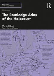
245 10|aROUTLEDGE ATLAS OF THE HOLOCAUST.
250 |aFifth edition.
260 |a[S.l.] :|bROUTLEDGE,|c2023.
300 |a1 online resource
490 1 |aRoutledge historical atlases
520 |aThe graphic history of the Nazi attempt to destroy the Jews of Europe during the Second World War is illustrated in this series of 363 detailed maps. The maps, and the text and photographs that accompany them, powerfully depict the fate of the Jews between 1933 and 1945, while also setting the chronological story in the wider context of the war itself. The maps include: Historical background - from the effects of anti-Jewish violence between 1880 and 1933 to the geography of the existing Jewish communities when the Nazi Party came to power The beginning of the violence - from the destruction of the synagogues in November 1938 to Jewish migrations and deportations, the ghettos, and the establishment of the concentration camps and death camps throughout German-dominated Europe The spread of Nazi rule - the fate of the Jews throughout Europe including Germany, Austria, Poland, Greece, Yugoslavia, Bulgaria, Russia, Denmark, Norway, France, Holland, Belgium, Italy, and the Baltic States Jewish revolts and resistance - acts of armed resistance, fighting in the forests, individual acts of courage Jews in hiding - escape routes, Christians who helped Jews The death marches - the advance of the Allies and the liberation of the camps, the survivors, and the final death toll. This new edition now includes an additional 30 of Martin Gilbert's maps, with many additional camp and ghetto maps, further illustrating the layout and organization of some of the most significant towns and cities affected by the Holocaust, especially useful to those visiting the sites.
588 |aOCLC-licensed vendor bibliographic record.
650 7|aHISTORY / General|2bisacsh
650 7|aHISTORY / Military / World War II|2bisacsh
650 7|aHISTORY / Reference|2bisacsh
650 0|aHolocaust, Jewish (1939-1945)|vMaps.
650 0|aHolocaust, Jewish (1939-1945)
830 0|aRoutledge historical atlases.
856 40|3Taylor & Francis|uhttps://www.taylorfrancis.com/books/9781003197294
856 42|3OCLC metadata license agreement|uhttp://www.oclc.org/content/dam/oclc/forms/terms/vbrl-201703.pdf
901 |aTaylor & Francis